

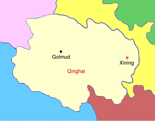
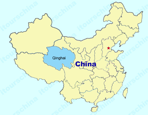
Qinghai Maps
Qinghai province is located in the northeastern part of the Qinghai-Tibet Plateau in Northwest China, with a large area of 720000 square kilometers, which makes it the fourth largest province in China. Qinghai province mainly consists of mountains and high plateaus, with an average elevation of over 3000 meters above sea level, featuring its natural landscape.
My Questions *We welcome and appreciate your questions & reviews