

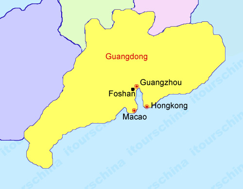
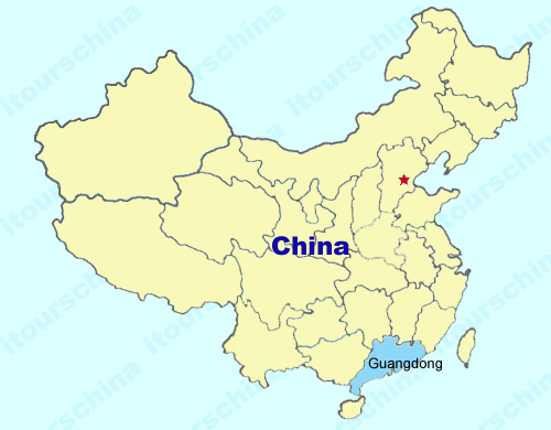
Guangdong Maps
Guangdong province is located in the southern part of China on the Nanhai Sea, bordering on Jiangxi, Hunan, Fujian and Guangxi provinces, covering an area of about 180000 square kilometers. Guangdong has the longest coastline and a great number of islands, with about 70% of smooth, low hills among the total land. See Guangdong maps as below.
My Questions *We welcome and appreciate your questions & reviews